NIGHTLIFE
- Name of map document (appears in dropdown)
- NIGHTLIFE
- Description to appear in introductory popup
-
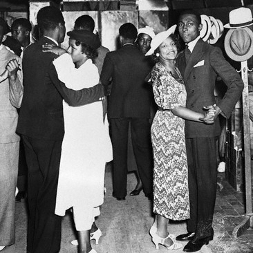
This map shows Harlem’s nightclubs, the speakeasies that became ubiquitous during Prohibition, and the buffet flats that black residents set up as an alternative to those venues.
The nightclubs are the most familiar of Harlem’s attractions, described in a range of sources. The presence of speakeasies is also well known, but they and their locations are discussed only in general terms. This map uses lists of locations regularly published in the New York Age as part of the editor’s efforts to get Prohibition authorities to take action. The third venue, buffet flats operated in residences, attract only a passing mention by scholars, but they became a concern for reformers at the end of the 1920s and the target of a 1928 undercover investigation by the Committee of Fourteen, a white antiprostitution organization.
Combining these sources shows that these nightlife venues had very different geographies. Nightclubs, many of which predated Prohibition, clustered around 135th Street and on and east of Seventh Avenue, locations that stretched from the core of black settlement toward the areas of white population. Speakeasies could be found far more widely in storefronts throughout Harlem, mostly on the avenues (including on Eighth Avenue, which had no other nightlife), with clusters in the vicinity of nightclubs. Buffet flats likewise operated at more widely scattered locations than nightclubs, but most were on cross streets, not avenues, with many above 140th Street, a largely residential district distant from whites. Whereas whites owned most nightclubs and speakeasies and catered to white or racially mixed crowds, blacks operated the buffet flats for black patrons, without publicizing their locations, thereby extending some of the privacy of a residence to their customers.
Mapping nightlife thus helps identify an unrecognized black response to Prohibition’s impact on Harlem: the creation of places where blacks could be apart from the whites who appeared in increasing numbers in the neighborhood’s nightlife.
For more on this interpretation of Harlem's nightlife, see Stephen Robertson, “Harlem Undercover: Vice Investigators, Race, and Prostitution in the 1920s,” Journal of Urban History 35, 4 (May 2009): 486-504.
- Featured map or Individual
- Featured map 1915 - 1930
- Map layers
- Nightclub
- Bromley Real Estate Map
- Speakeasy
- Buffet Flat
- Black Harlem 1920
- Black Harlem 1925
- Black Harlem 1930
- Map zoom bookmarks
- Harlem, -73.9800,-73.930000,40.79,40.83,1915,1930
- Western hemisphere,-90,0,-20,60,1915,1930
- Minimum zoom (km)
- 0.00005
- Maximum zoom (km)
- 10
- Show legend on startup
- Hide legend on start
- Suppress timeline
- Suppressed
- Media
-
 nightlife.jpg